Introducing the next generation software platform
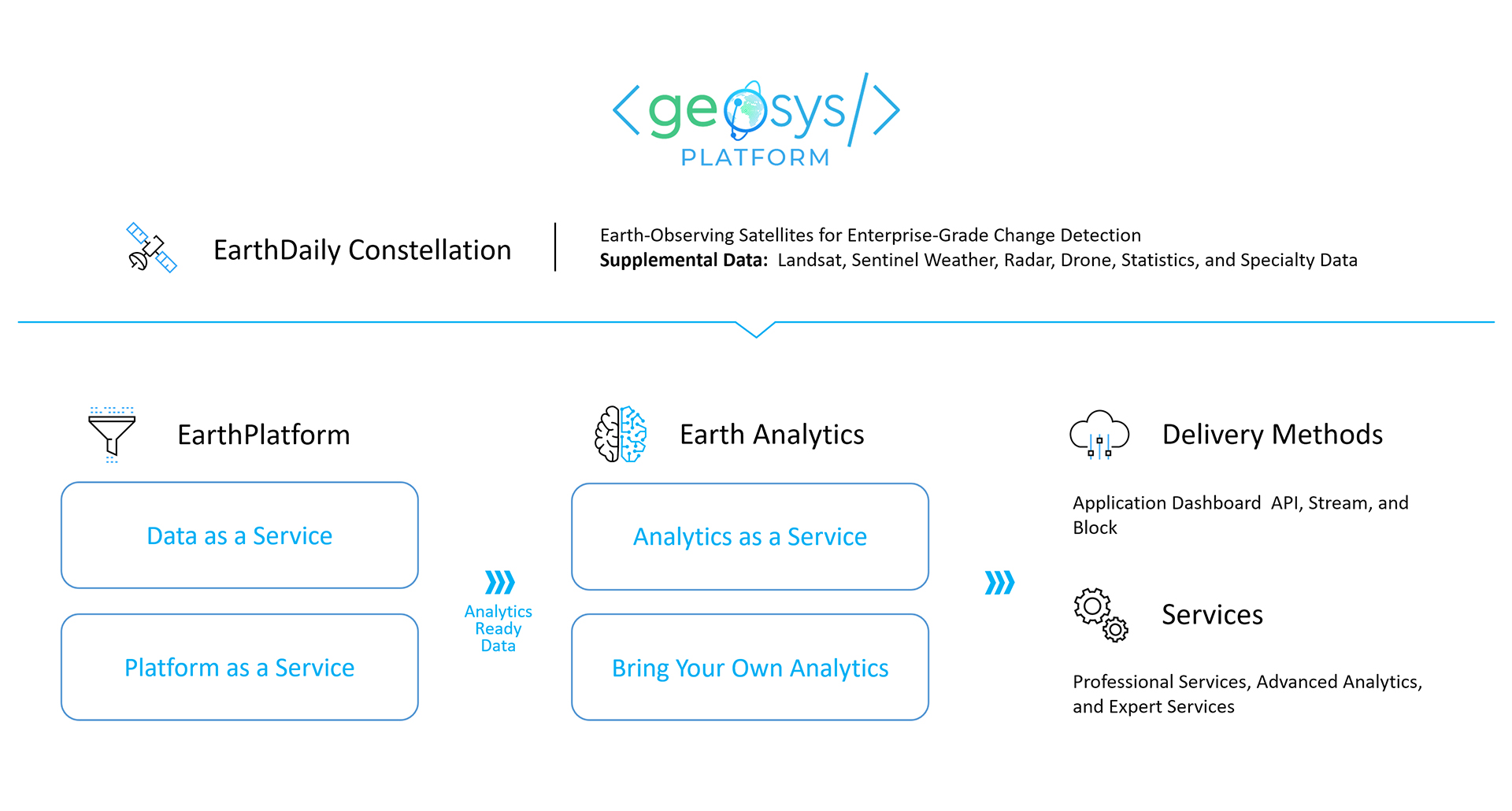
The geosys Platform is a cloud-based service that provides the critical capabilities needed throughout the analytic process - from data connectivity to the data preparation and enrichment needed to create analytics-ready data, to advanced analytics and modeling, to flexible delivery options that provide reporting, visualization, and collaboration - all without compromising security or governance.
Advanced data collection, processing, and presentation converge on the EarthDaily Agro geosys platform.

Explore API Catalog
Field Vegetation
Indexes Maps
NDVI (Normalized Difference Vegetation Index), EVI (Enhanced Vegetation Index), CVI (Chlorophyll Vegetation Index), GNDVI (Green Normalized Difference Vegetation Index), LAI (Leaf Area Index) and more if needed.
Color composition maps: True and False colors maps used to visualize vegetation cover.
Vegetation Time series: vegetation growth measured daily
Field Agronomy
Maps
Yield Variability and Yield Goal Map
Organic Matter Map
Satellite derived Management Zones
Elevation and slopes map
Nitrogen application maps (for wheat, barley, canola and more)
Weather Data
Multi-model dataset covering historical, current weather and forecasts
Several aggregation levels: admin unit, small ag region and location based
Ag parameters: temp min, max, average, rainfall, wind speed, humidity, snow depth, atmospheric pressure, soil moisture and temperature Precipitations (Daily)
Notifications and
Warnings
Get information as soon as available on our Platform, and focus on key information or anomalies
New satellite image notification
Difference map with anomaly detection
Fields benchmarking
Vigor status change
Our purpose is to deliver easy-to-use analytics that reduce everyday risks, making agriculture more resilient.

Precision for Digital Ag Companies
Digital Ag Companies are now able to manage trials, verify sustainability and measure weather impacts more successfully and efficiently.

Visibility for Fintech Companies
Lenders and insurers verify farmer’s planting dates, control crop progress, forecast the health of crop produce, as well as detect any fraud. Therefore, mitigating risks becomes vastly easier.

A Head Start for Commodity Traders
Trading firms leverage insights before they are made public by government reports, and easy API integrations feed seamlessly into trading platforms and models.

Security for Food & Beverage Companies
Food & bev manufacturers ensure supply disruptions are reduced. Moreover, they are able to manage demand through proactive pricing strategies.


