Major Brazilian Bank Harnesses Data to Efficiently Manage Rural Credit Accounts
Remote satellite imaging and analytics gives bankers advanced tools for monitoring crops throughout the growing season, helping to validate rural credit and comply with government audit regulations.
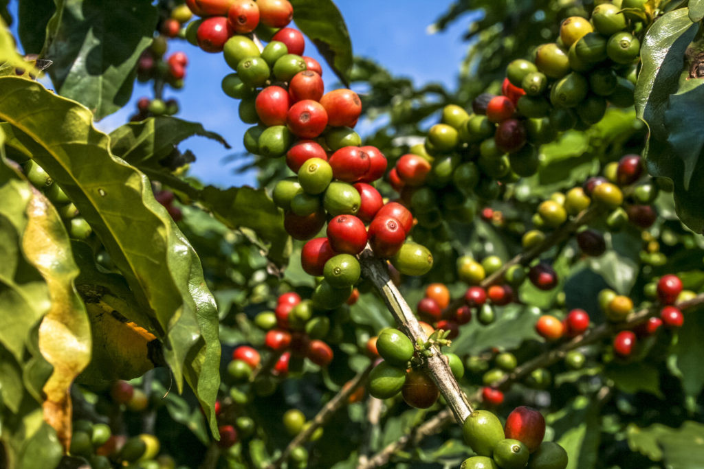
As one of the largest agricultural producers in the world, Brazil supports its farmers through a vast rural credit program—in 2018 the amount available to farmers was US$57 billion (R$218 billion). Banks that distribute these loans must comply with a variety of government audit regulations, and all while needing to protect their own bottom lines. That’s why a major Brazilian banker specializing in rural development relies on Earth Observation data from EarthDaily Agro for ground-level analysis of crops and weather to efficiently manage its financial resources.
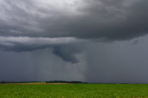
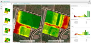
EarthDaily Agro’s powerful <geosys/> platform combines scientific-grade satellite imagery with powerful geospatial analytics to help bankers make informed decisions based on weather and soil conditions. The platform’s multi-modal weather data set covers historical and current weather as well as weather forecasts. The <geosys/> field-generated index includes NDVI, EVI and additional indexes. Field agronomy indexes include yield variety and yield goal maps. Normalized data makes it easy to focus on the change detection and remove the temporary interference.
The indexes are adjusted for atmosphere (clouds, haze and smoke), sun angle (corrected for comparison across time and source), as well as masking (clouds and shadows that interfere with quality data are omitted) to render the most precise image possible. This normalizing of the data makes it easier to compare day-over-day, month-over-month and year-over-year.
“The quality and reliability of <geosys/> data allow us to monitor crop production throughout the growing cycle for better risk management and compliance with government audit regulations.”
With this information, loan officers create customized reports for analysis throughout the growing cycle, from planting through mid-season to harvest. Maps and analytics drill down to the field level, allowing loan officers to efficiently and remotely analyze a vast region with of over 3,000 farmers who grow 50 different crops.
Audits play a key role in the lending process because the funds are a mix of public and private resources. The geoanalysis validates crop production and provides data for audits such as Brazil’s Rural Credit Manual (MDR).
As a result of knowing field-level conditions, loan officers manage risk, respond quickly and accurately to audits and help farmers improve and expand crop production.
On the horizon:
Daily observation from EarthDaily Analytics
Coming soon, EarthDaily Analytics, the parent company of EarthDaily Agro, will launch the EarthDaily satellite constellation, one of the world’s most powerful global change detection and analysis systems. Through a unique combination of 23 spectral bands, the satellites will collect scientific-grade and analytics-ready imagery of the Earth’s surface captured every day, at the same time of day and made available within hours through a cloud-based platform.