Satellite remote sensing reduces risk for agriculture credit lending
Geospatial data tools allow the crop history of each field to be analysed for better decision-making or lenders and growers
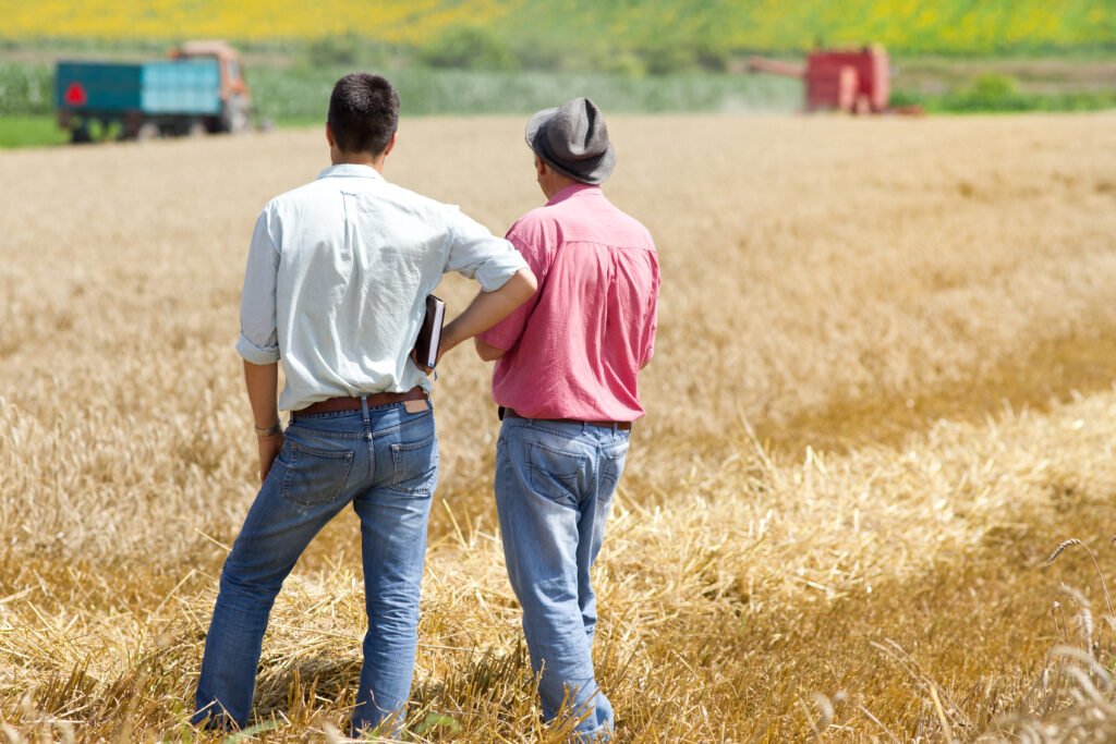
| Farming credit has been a fundamental tool for the development of Brazilian agriculture for decades, growing significantly to meet the demand of the Brazilian agricultural sector. Between 1995 and 2018, the amount of credit officially offered grew an average of 8% per year, jumping from R$30.5 billion in 1995 (in today’s values), to over R$182 billion in 2018. Since agriculture and cattle raising is a capital intensive activity with long production cycles – the capitalization of the producer is essential to increase their purchasing power, promoting the modernization of production techniques and, ultimately, increasing productivity of the sector as a whole. Therefore, access to capital through credit is clearly one of the most important inputs for Brazilian agribusiness.Even with all this increased amount of credit offered, the sector needs even more. Even with weather conditions favorable for high productivity, producers investing in fertility, genetics and machinery, the Brazilian agribusiness absorbed all this officially available credit and still had appetite for more. The growing demand for farm credit combined with a clear return for lenders led to a unique movement in Brazil, where other sources of credit developed and today are essential for the rural producer. Pesticide, fertilizer, seed, commodity and retail suppliers organizations today play an essential role in the supply of credit to Brazilian agribusiness.
Jaqueline Freitas, Head of Sales at Traive Finance, a credit startup based in the US and Brazil, conducted a pioneering analysis on the dynamics and origin of the credit that irrigates all Brazilian agribusiness and came up with very interesting results. “Lack of knowledge of the level of debt and risk, information asymmetry and high collateral risks made banks choose not to finance an important slice of producers. This slice was then filled by alternative financiers that today together represent about 50% of the Brazilian costing market”, noted Jaqueline. By analyzing the ten main crops in Brazil such as soy, corn, wheat, sorghum, cotton, coffee, sugarcane, rice, beans and oranges, the study concluded that there was a capital demand of around R$ 169 billion for the 2018/19 harvest. This capital to finance production came from different sources, with banks accounting for a little over R$ 70 billion (45.2% of the total), retailers and cooperatives contributing R$ 29 billion (17.2%), the pesticide industry contributing R$ 23 billion (13.7%) and trading companies contributing R$ 16.9 billion (10%). The rest of the capital demanded for the 10 main crops of the 2018/19 harvest came from the producer’s own pocket, accounting for more than R$ 23.5 billion, or about 13.9% of the total crop funding. “So that all these market players can continue to offer more and more credit at competitive costs and low risks, the tools that allow quantifying these variables become more and more important. The use of remote sensing is one of these tools”, Jaqueline says. Today, banks and trading companies adopt this type of technology on a large scale, with significant savings in the process of risk assessment and crop monitoring. With the regulation of the use of these techniques by the Central Bank in 2015, the trend is that the general credit market will increasingly adopt specialized solutions for crop monitoring and granting credit at more competitive values and with lower risks. EarthDaily Agro, a company that monitors agricultural areas using satellite data, is an ally in this regard. The company offers remote sensing solutions for the agricultural credit market, insurance, precision agriculture and commodities, providing from customized services to ready-made solutions and APIs for 30 years. “There are more than 200,000 maps delivered daily through remote sensing work, worldwide, and 20 million hectares of agricultural areas monitored annually,” explains Pedro Ronzani, business manager at EarthDaily Agro Brazil. “Massive geospatial data analysis tools allow lenders to more efficiently and precisely analyse the profile of each property and make better decisions, generating important savings through systematic risk reduction or a better equalisation of the risk-return ratio of each financial operation. Besides this, the monitoring of the assets in guarantee (from the land to the crop that is growing on the farm) can be greatly optimised with the use of remote sensing techniques”, analyses Pedro Ronzani By combining efforts with specialized companies such as EarthDaily Agro, players in the agricultural credit market are able to focus greater efforts on their core activities and thus have an even more robust management of their creditors. These solutions have become possible and valuable in recent years with the increase in computer processing capacity, acquisition and treatment of satellite and radar images, as well as the preparation of the agricultural sector for rapid absorption of these technologies. All this culminates in the generation of extremely accurate data, providing high-quality analysis and insights that bring value to the entire agricultural credit chain. |