Posts Tagged ‘Home’
Time Series Mastery: How to Use Field History to Enhance Future Agronomy
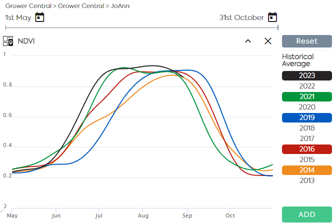
Satellite Imagery allows users to monitor near–real–time crop growth conditions along the vegetation cycle. A Satellite Image Time Series is a sequence of images taken over the same area at various intervals. Time series of indices derived from reflectance data, such as NDVI and LAI are used to assess the evolution of the vegetation and…
Read MoreUnlocking the Potential of Remote Sensing: Estimating Winter Cover Crop Biomass Using Sentinel-2 and Machine Learning
In the pursuit of sustainable agriculture and climate change mitigation, understanding and quantifying the biomass of cover crops during winter fallow periods is crucial. However, traditional methods for estimating cover crop biomass often lack spatial precision and objectivity. In a groundbreaking study published in Remote Sensing, researchers have harnessed the power of remote sensing technology…
Read MoreEmployee Spotlight: Caroline Gevaert
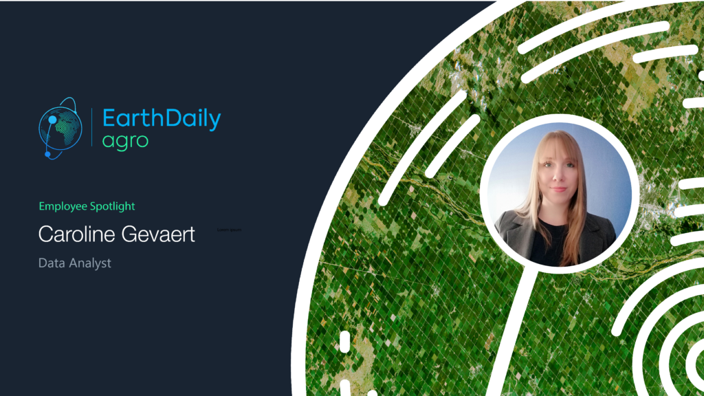
How long have you been at EarthDaily Agro? I joined EarthDaily Agro 12 years ago. What’s your current position, and what does it entail? My current role as a Data Analyst involves transforming raw data into useful insights. I am responsible for collecting, processing, and analyzing data to provide valuable materials to data scientists.…
Read MoreEmployee Spotlight: Eva Totain
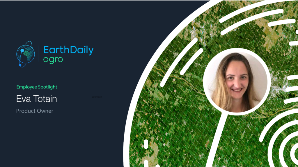
How long have you been at EarthDaily Agro? I joined EarthDaily Agro four years ago. I have a master’s degree in Agronomy from the Engineering School of Montpellier Supagro. I lived in Brazil for six months during a student exchange program, where I had the chance to discover more about remote sensing and new technology…
Read MoreEarthDaily Agro and Infopulse Help a Large Ukrainian Agro-holding Access Precision Agriculture
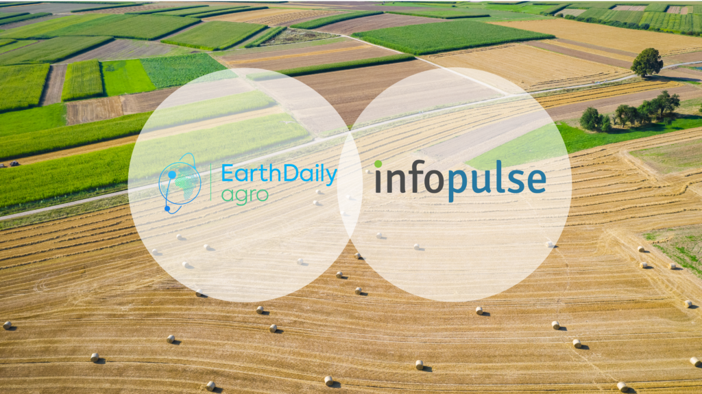
Aiming to enable data-driven decisions and ensure more efficient use of its resources, one of the leading industrial agro-holdings in Ukraine decided to adopt the precision agriculture approach. The company’s primary objective was to engineer a modern cloud-based data platform that would gather, consolidate, and analyze vast volumes of agricultural data, including high-resolution satellite images…
Read MoreEmployee Spotlight: Alexis Durand
How long have you been at EarthDaily Agro? Three years. What’s your current position, and what does it entail? I am a data scientist and as such I am responsible for creating analytics based on machine learning and deep learning. Specifically, I work on detecting objects in satellite images, such as irrigation systems (pivots). I…
Read MoreEmployee Spotlight – Yuriy Pekun

While working at the Ministry of Finance of Ukraine, Yuriy Pekun discovered a deep passion for agriculture. This led him to pursue and obtain a master’s degree in agronomy and crop science, which was a turning point in his career. Before joining the EarthDaily Agro team, he served as an agronomist for seed growing companies.…
Read MoreSatellite – Scaling Up Carbon Farming
In recent years, many studies on carbon farming practices have been done. Optimizing carbon capture on working landscapes is expanding in the United States and in other major production areas around the world. In coordination with these efforts, a framework is being structured that encompasses political and financial incentives, regulatory frameworks, contracted production, and debate…
Read MoreAntarctica Capital Announces Formation of EarthDaily Analytics
NEW YORK, April 21, 2021 – Antarctica Capital, an international private equity firm, today announced the formation of EarthDaily Analytics (“EarthDaily”), an integrated data processing and analytics company offering advanced digital products and analytics for delivery to the world’s rapidly expanding global agricultural industry. EarthDaily Analytics utilizes satellites to collect vast amounts of raw imagery…
Read MoreEarthDaily Agro Appoints Veteran Sales and Marketing Executives to Support Global Growth

EarthDaily Agro announced the appointment of David E Gray as Global Director of Sales & Business Development and J. Andrew Mullin as Global Director of Marketing. Gray and Mullin join the leadership team of EarthDaily Agro to scale the worldwide sales and marketing organization, supporting the company’s rapid growth. Gray is a recognized leader of…
Read More