To the Last Drop: How Agribusiness Decision-Making Becomes Clearer, Simpler and More Impactful With Earth Observation
Agtech innovation has made today’s industry more sophisticated than ever. But with sophistication comes complexity. Every day, agribusiness leaders — across fintech, commodity trading, food and beverage, digital ag and more — are tasked with making complex business decisions. The trouble is the complicated, inconsistent and incomplete information they’re often equipped with is insufficient for making confident, informed decisions — particularly when those decisions concern in-season operations scattered across a country or even globally.
Increasingly, agribusiness problem-solvers are turning to new advances in Earth Observation technology to arm themselves with clear, simple and complete geospatial insights — enabling them to make decisions that are timely and rooted in accurate data.
“Whichever part of the ecosystem you work in, decisions in agriculture, by its own nature, involve an inherent level of risk,” said Dave Gebhardt, general manager of EarthDaily Agro a leading geospatial analytics provider for agribusiness. “And as the industry has evolved, so have the stakes. It’s important to recognize that, as a leader in ag, your decisions are only as good as the data you base them on. Not taking advantage of best-in-class geospatial analytics is a missed opportunity.”
Earth Observation has a long history serving agriculture, from governments to many different types of agribusinesses. Recently, new advances have equipped providers with greater ability to drive even more value.
“In the past, our greatest challenge has been the quality, frequency and coverage of existing satellite systems needed to support our large enterprise customers,” Gebhardt said. “What’s more, the technology of yesteryear often left users wanting more, largely because only so much could be measured with satellite imagery produced using just four or eight spectral bands. Even if you supplemented the data with additional sources, the composite product that resulted was still low-resolution and couldn’t be updated frequently.”
Fast forward to today, though, and that’s quickly changing. Recent years have seen a variety of developments to Earth Observation that automate analytics and expand the type of crops and types of measurements — such as water and soil health — that can be monitored. Additionally, cloud storage, advanced analytics, flexible APIs, increased processing power and more have made today’s geospatial analytics easier to integrate into existing systems and workflows, driving higher value outcomes for customers.
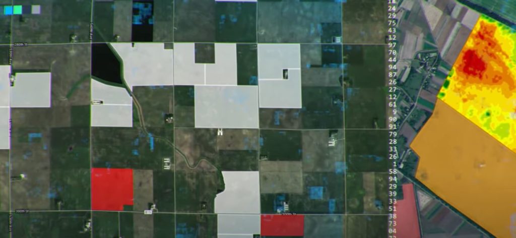
“The EarthDaily Agro geosys platform allows us to provide refined and automated analytics for understanding the impact of water, nutrition, soil health and production practices on crop health and progress,” Gebhardt said.
In practice, these advancements to today’s geospatial analytics equip agribusiness with more power to tackle the industry’s toughest challenges. Combining historical data, automated change detection, yield forecasting and more, modern earth observation is about answers rather than just data. Integration into business workflows clarifies uncertainties so leaders can make decisions with confidence:
- Lenders can get trustworthy visibility into the health of a borrower’s crops.
- Insurers can accurately predict risk when considering policy applications.
- Commodity traders can act fast based on global market insights in near real-time.
- Food and beverage manufacturers can protect their supply with proactive monitoring.
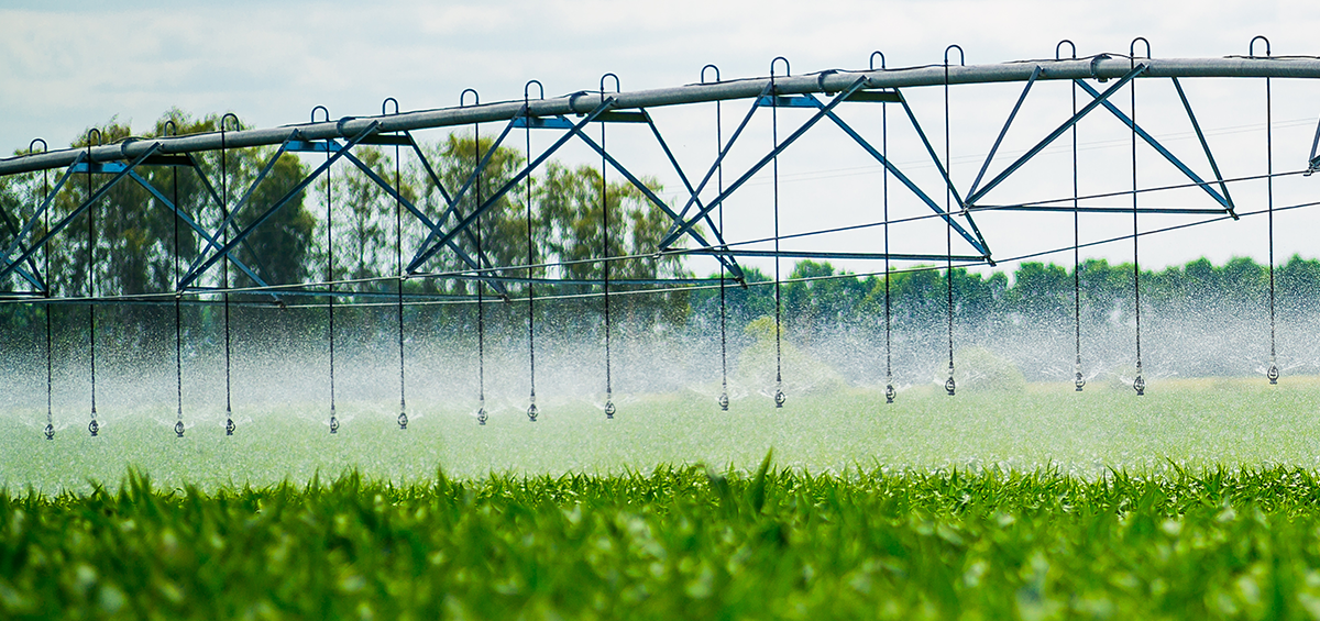
“One of my favorite examples of the power of geospatial analytics is water management,” Gebhardt said. “Whatever your stake is in a farmer’s success, nothing impacts the health of their crops more than water. With Earth Observation enhanced analytics, you gain valuable insights like whether water is limiting crop progress, how well an irrigation system is performing, how efficiently a farm is using water and more.”
According to Gebhardt, a high-quality geospatial analytics partner can be an invaluable resource. To maximize the benefits that Earth Observation can offer, he advises agribusinesses that it’s important to choose a partner carefully. When evaluating potential partners, Gebhardt recommends considering the following criteria:
- Quality of data collected
- Frequency of data refreshment
- Scale of data collection, on field, region, country and continent levels
- Ability to measure staple commodities, row crops, cereal crops, and more
- Ability to define why monitored crops are healthy or not healthy
- Ability to determine how the health of a crop is affected by factors such as water, weather, planting conditions and harvest conditions
- Ability to provide historical data, detect change and forecast future outcomes
- Data processing that enables users to scale advanced analytics capabilities
- Ability to provide all of the above at the right time and with the right level of integration into your business decision workflows
EarthDaily Agro delivers robust capabilities that will be further enhanced with their planned EarthDaily satellite constellation. Currently under construction, the constellation will harness the power of 22 spectral bands — providing more detailed insights than ever possible before. The result is a single, seamless, and consistent source of truth that agribusiness leaders can depend on to inform their decisions.
“Ultimately, choosing an Earth Observation partner boils down to quality, frequency and coverage,” Gebhardt said. “Simply put, more spectral bands equals more answers, which is why the EarthDaily constellation will see more of the things ag needs to see, especially early identification of water stress thanks to daily measurements of every single field worldwide. With daily frequency and high-resolution imagery that is compatible with a variety of tools, the new constellation will make it easier to deliver immense value for agribusiness by helping leaders make more informed, more confident decisions.”